
Looking for hiking trails near Nashville?
Ever wonder what it’s like to hike on the Old Trace?
(The Old Trace is an historic stretch of roadway between Tennessee and Mississippi that today is merely a worn down foot and horse path in the few places where it remains.)
Here are highlights, plus photos, of our favorite place to hike on the Natchez Trace Parkway:
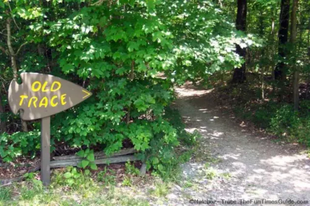
The Old Trace trail at milemarker 426.3 along the Natchez Trace Parkway.
Our Experience Hiking Near Nashville
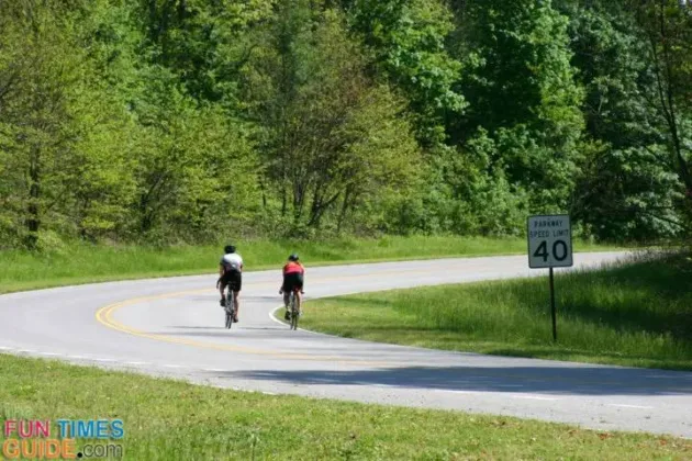
To date, we have driven, biked, walked, motorcycled, and hiked the Natchez Trace Parkway.
(We haven’t RV’ed it yet, but we hope to soon!)
Without a doubt, this is our favorite Natchez Trace hiking trail.
Hiking The Old Trace
In effect, the Old Natchez Trace hiking trail falls between milemarker 426.3 to milemarker 427.6 on the Natchez Trace Parkway.
Seems simple enough, right? However, it’s really a 4+ mile loop by foot!
Since it’s not a straight shot, and this is all backcountry deep woods hiking, it’s a fairly serious hike. While you could turn back and repeat your steps at any point, there’s really no “turnaround spot” or anything. It’s a clearly marked 4-mile loop that is meant to be enjoyed from start to finish.
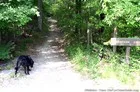
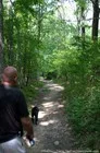
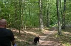
And that is what we did… with our dog!
Photo Highlights From Start To Finish
It took us exactly 2 hours to complete this loop. It was a hot summer day, so that slowed us down a bit. And we had our dog in tow (…but that probably kicked up our pace a notch or two!)
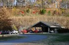
We also stopped for 10 minutes at the halfway point — Garrison Creek rest area.
Okay, here we go…
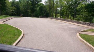
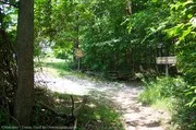
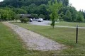
Start by parking your car in the relatively small parking lot. (I guess that means few people actually park & hike from here. Perhaps more people start at the Garrison Creek rest area and work their way back to here… there’s plenty of parking there!)
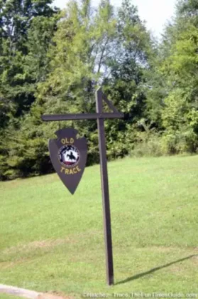
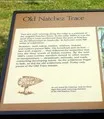
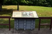
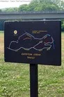
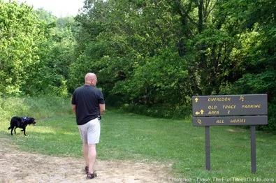
From the parking lot, walk up a little hill toward the woods (away from the Parkway) and take a moment to read the signs explaining the history behind the Old Trace routes.
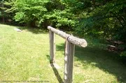
Looking toward the woods, you will see the entrance to this Natchez Trace hiking trail, as well as a picnic table and hitching post for horseback riders.
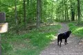
And we’re off!… It’s a woodsy entrance. The first time we hiked this trail, we weren’t sure what to expect. We did cross paths with a couple of other hikers along the way, but no horseback riders on this particular day.
Before long, you reach the part where the actual “loop” begins. I know of a few people who’ve done this loop backwards, but we haven’t yet. We went left at the fork in the road and headed on to Garrison Creek.
For the most part, it’s a clear-cut path that appears to be well-traveled. There is a lot of tall foliage that you can’t help but brush against (…which probably explains all the ticks. More on that later). Most of this pathway is shared with horseback riders.


One unique feature on the Old Natchez Trace hiking trail is this underground tunnel. It goes under the Natchez Trace Parkway itself, and takes you to the other side of the Trace. Up to this point, there were no water crossings.


The only real “obstacle” on this hiking trail is water! There are several water crossings after the tunnel — a couple of them are fairly deep. On this particular hike, Tennessee was experiencing a drought. So that might give you some idea of how deep these water crossings might be normally.
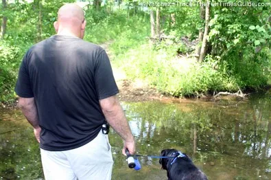
And a word of caution: Jim actually fell in the first water crossing we encountered. Not because it was so deep, but because it was so slippery! The rocks below the water’s surface were completely covered in moss — and if you lose your footing, you’re a gonna fall in. (It’s not that bad though… pretty shallow… just remember to secure your valuables before you start crossing these creeks and streams.)


This is what it looks like when you emerge from the wooded trail into great wide open at Garrison Creek on the Natchez Trace Parkway. A few hundred feet away is where the trail picks back up — near the Garrison Creek restroom/comfort station.


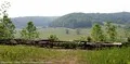
This is the halfway point. From this point on, there’s no more water — just picturesque woody scenes and landscapes.


These are some of the views that can be seen from the Old Natchez Trace hiking trail. This second half of the trail is the most beautiful.


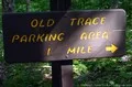
Fortunately, there are signs at key points along the way — which give you a sense of direction and an idea of how much farther you’ve got until the end.

The only downside to this or any other hike along the Natchez Trace Parkway: ticks! They are inevitable. Fortunately, most of them are not the Lyme Disease carrying ticks — just ticks that leave tiny little bite marks and nasty welts that itch forever! It took us 3 days to remove the last tick from ourselves and our dog. There were 35 in all! In fairness, we didn’t take the proper precautions on this trip by using tick-repellent or dressing appropriately.
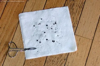
Here’s all of the info I’ve compiled about my experience with ticks here in Tennessee — including pictures of ticks that are known to carry Lyme Disease, and how to remove a tick from your body.

We’ve lived in the Nashville area since 2001 — and all 3 of our houses have been situated relatively close to the Natchez Trace Parkway. To me, the ‘The Trace’ is a hidden gem of Nashville — a place to go when you want to get away from it all and be one with nature. I’ve hiked it, biked it, motorcycled it, walked it with my dogs, and driven my car on The Natchez Trace Parkway more times than I can count! This is where I share some of my favorite things to do along the Natchez Trace Parkway — which runs 444 miles from Nashville Tennessee to Natchez Mississippi and through parts of Alabama. When I’m not enjoying the beautiful outdoors along the Natchez Trace Parkway, you’ll find me at the corner of Good News & Fun Times as publisher of The Fun Times Guide (32 fun & helpful websites).