Jim and I have driven the entire length of the Natchez Trace Parkway — from Tupelo Mississippi to Nashville Tennessee — several times. (We have a friend who lives in Starkville, Mississippi. Enough said.)

In total, the Natchez Trace Parkway covers 101 miles in the state of Tennessee, and passes through 7 Tennessee counties (from north to south):
- Davidson
- Williamson
- Maury
- Hickman
- Lewis
- Lawrence
- Wayne
The Tennessee part of the Natchez Trace Parkway spans from mileposts 341 to milepost 444.
Fun Ways To Explore The Trace
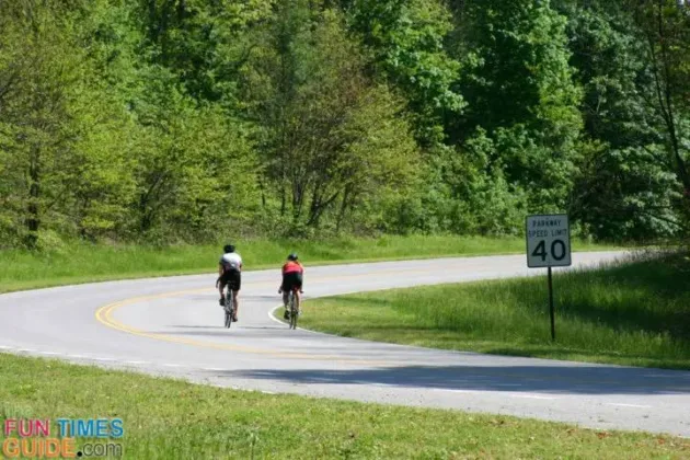
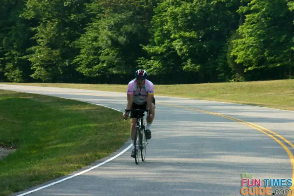
In addition to driving on the Natchez Trace Park for years, I’ve also biked the northernmost end of the Trace more times than I can count.
Mostly, I ride my bike from the Garrison Creek parking area just past the Leiper’s Fork exit (Hwy 46) — all the way to the very end of the Parkway at Highway 100 in Nashville (near the Lovelace Cafe).

That’s my favorite out & back biking route along the Natchez Trace — roughly, from mileposts 427 to 440.
Did you know?… The Natchez Trace Parkway is rated one of the Top 10 Biking Routes in the country!

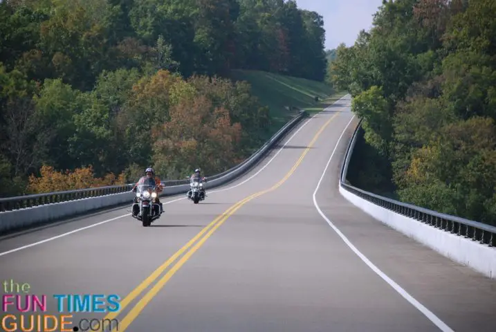
After we got our first motorcycle (now we’re on our third!), I added motorcycling the Natchez Trace Parkway to my list of fun things to do in Nashville.
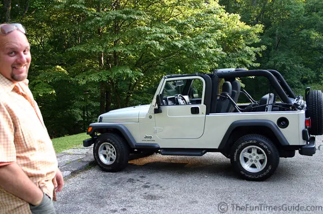
But mostly, we like to hop in our Jeep Wrangler and take leisurely rides on the Trace. (Yes, we usually take our dog with us.) We turn around whenever the mood strikes us. And we stop & see whatever we feel like stopping and seeing. It’s such a relaxing way to spend a day!

Following are my tips if you want to see what the Natchez Trace Parkway is all about, but you only have a very short time to do so…
The Quickest Tour Of Nashville’s Natchez Trace Parkway
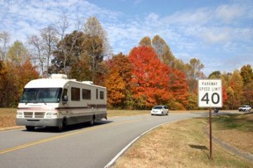
Auto touring the Natchez Trace Parkway is definitely worth it — no matter how much time you actually spend there.
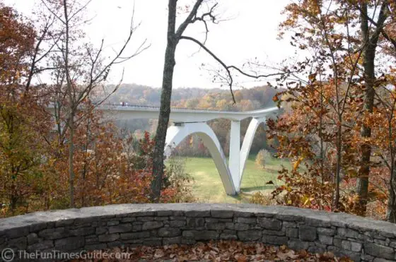
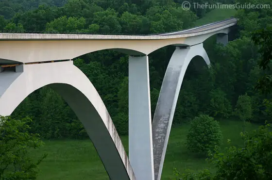
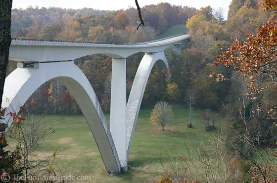
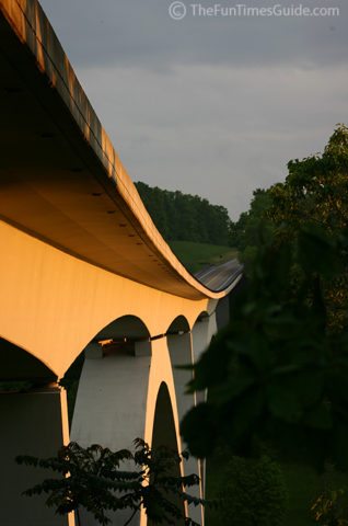
For the quickest trip, your best bet is to hop on at Highway 96 W (on the west side of Franklin). When you spot the huge expansion bridge overhead, you’ll know you’re there.

Then, at the top of the ramp when you reach the Natchez Trace Parkway itself, turn left again and ride south a few miles.
Just past the Leiper’s Fork exit, there is a rest area with very clean public restrooms and a picnic area. It’s on the left.

The best part: There, you can get a FREE printed full-color map that shows all of the places along the Trace that you might be interested in visiting — on this trip, or on a future drive along the Natchez Trace.
If you’re short on time, when leaving the rest area, just head back the same way you came on the Natchez Trace Parkway (north).
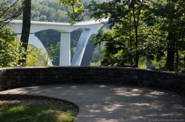
Only this time, go past the Franklin Hwy 96 exit where you first entered the Parkway, and take a quick ride across that big expansion bridge! What a feeling (…especially on a bicycle).

Immediately past the bridge, there’s a parking area on the left — along with a few hiking trails. Plus, you can actually walk around and under the bridge itself!
When you’re done taking pictures there, hop back on the Trace and continue north to the very end of the Natchez Trace Parkway at Highway 100.
There’s a really nice gas station (a Daily’s Shell station) and BBQ restaurant (Bar-B-Cutie) there, as well as the Lovelace Cafe and its many shoppes.
So there you go… now you can say you’ve ridden the Natchez Trace Parkway.
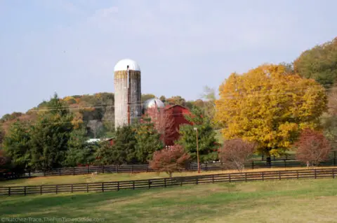
But if you ever get the chance, you really must come back and drive the Natchez Trace Parkway in the Fall!
Did you know?…
The Natchez Trace Parkway is the 8th most visited park in the National Park System.

We’ve lived in the Nashville area since 2001 — and all 3 of our houses have been situated relatively close to the Natchez Trace Parkway. To me, the ‘The Trace’ is a hidden gem of Nashville — a place to go when you want to get away from it all and be one with nature. I’ve hiked it, biked it, motorcycled it, walked it with my dogs, and driven my car on The Natchez Trace Parkway more times than I can count! This is where I share some of my favorite things to do along the Natchez Trace Parkway — which runs 444 miles from Nashville Tennessee to Natchez Mississippi and through parts of Alabama. When I’m not enjoying the beautiful outdoors along the Natchez Trace Parkway, you’ll find me at the corner of Good News & Fun Times as publisher of The Fun Times Guide (32 fun & helpful websites).